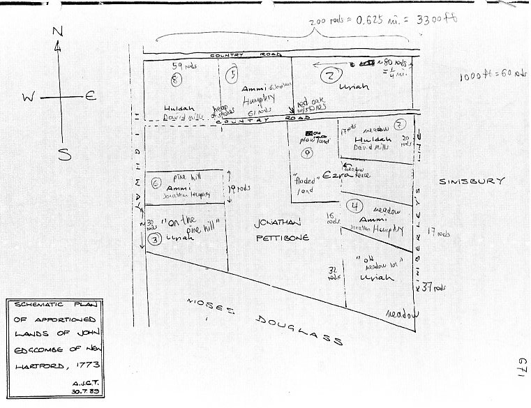
Diagram showing the distribution of the estate of Lieutenant John Edgecomb in 1773 1, drawn by Alan Taylor in 1989 with annotations by Steve Baskauf.
Determining the location of Lieutenant John Edgecomb's land
Diagram showing the distribution of the estate of Lieutenant John Edgecomb in 1773 1, drawn by
Alan Taylor in 1989 with annotations by Steve Baskauf.
In 2013, I had the opportunity to travel through Connecticut and decided to take the opportunity to try to figure out where Lieutenant John Edgecomb and his son Uriah (c.1740-1810) lived. The primary clue about this was the record of the distribution of John's estate1. Unfortunately, because property descriptions of the time were based on the location of thingss like certain trees, heaps of stones, and country roads, it is not straightforward to determine where a discribed piece of land is located.
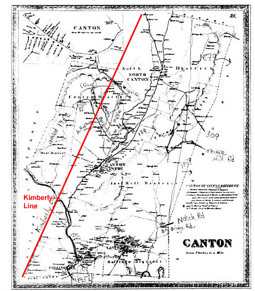
Map of Canton in 1869, published by Baker & Tilden, Hartford, Connecticut.
The biggest clue present in the description is that the property is bounded on the east by "Kimberly's Line". A bit of research made it possible to determine where the Kimberly Line was located. The Kimberly Line was originally the western edge of Simsbury. In 1762, lots to the west of the Kimberly Line were annexed by Simmsbury from New Hartford. This area is the westward bulge visible on the map above. This explains how John Edgecomb was first described as "of New Hartford", but later his family was described as "of Canton": Simmsbury annexed the land from New Hartford, then West Simsbury broke off from Simsbury, and finally West Simsbury became known as "Canton". The Edgecomb family could have been described as being from all of those places without ever moving.
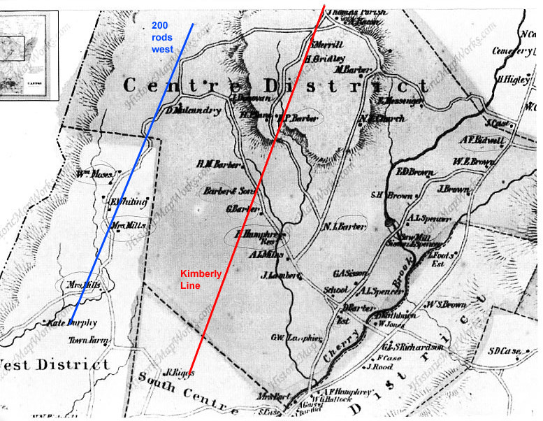
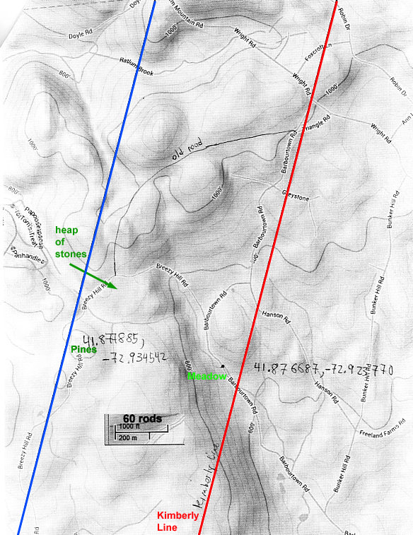
Enlargement of 1869 map with the Kimberly Line marked on the right and a parallel line 0.625 miles to the west.
Since we know that the land was in Simsbury, but west of Kimberly's Line, that leaves a relatively small area in which it could be located. The distance between Kimberly's Line and the highway on the western edge of the property was described as 200 rods, which corresponds to 3300 feet or 0.625 miles. The map above shows the location of the Kimberly Line and a parallel line at a distance 200 rods to the west. We can see that there is in fact a road that corresponds roughly to the western line - presumably this is the "highway" mentioned in the property description. Where is the "country rode" that bounds the property on the north? The 1869 map provides two possibile roads that connect the two lines from west to east. One heads east, then south and is the current route of Breezy Hill Road. The other possibility is an extension of the "highway" that heads north, then turns east. That road no longer exists as an actual road - the Ted Wright Trail begins on part of that old road. Based on various clues and a comparison of the described landforms relative to what I observed currently, I think that the Breezy Hill Road route is the most likely the "country rode".
1855 Map seen in the Canton Historical Museum - contains many of the same names as in 1869.
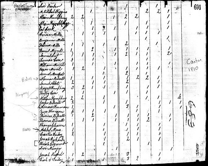
United States Census for Canton, Connecticut, 1810.
There is one more historical source of clues to tell us whether I'm on the right track or not. I looked at the census record that enumerates Uriah Edgecomb (c.1740-1810) to see who his neighbors were. Although there is not an exact geographical correspondence between where people lived and the order in which they are listed in the census, the census-takers generally went from one household to the next and as a consequence, neighbors tended to be listed near each other in the census listing. If we presume that Uriah was living on the land that he inherited from his father, the heads of household listed in the 1810 census would represent families that lived in the vicinity of the described property. Although almost 60 years had passed between the census and the publication of the 1869 map, there are still more family names that correspond than one would expect at random. Barber, Mills, Bidwell, Humphrey, and Moses are all names that appear both in the census record and on the map in the putitive area where the Edgecomb land was located.
Present-day map of the area, showing topography and names of current roads.
Having determined what I believed to be the area in which John Edgecomb's land was located, I set out to see what it looked like now. I started by driving up Barbourtown Rd. from Highway 179. This road follows Barbour Brook and in the area near where it crosses the Kimberly Line, there is some land that could actually be described as "meadow or "flooded land" - a description applied to several of the parcels on the eastern side of the Edgecomb land bordering the Kimberly Line.
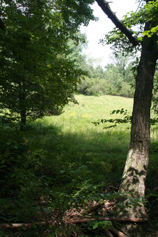
Meadow land near Barbour Brook.
In this vicinity, I also observed the last human habitation that I saw before I headed up Breezy Hill Rd.
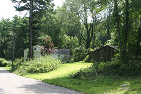
Home and barns along what was probably the northern "country rode"
As I drove up Breezy Hill Rd., the land became completely wooded and as the road turned south, it began to degenerate to the point where I wasn't sure whether my little car was going to make it through the ruts in the road. Much of this part of Canton has been purchased by the Canton Land Trust which maintains it in a natural state for public enjoyment.
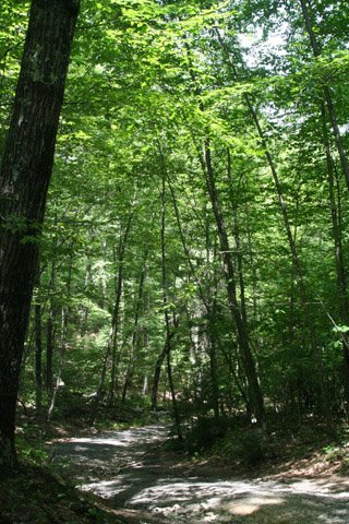
Breezy Hill Rd., a.k.a. the "highway"
The property descriptions describe the western plots laid out for Ammi Humphrey and Uriah as "on the pine hill". There are not enough distance measurements given in the property description to know how far south along the "highway" the pine hill is from the "country rode". However, the present day topo map shows a hill at what seems like about the right location. And it was the first place on my drive where I actually observed pines along the side of the road - more circumstantial evidence that I was in the right place.
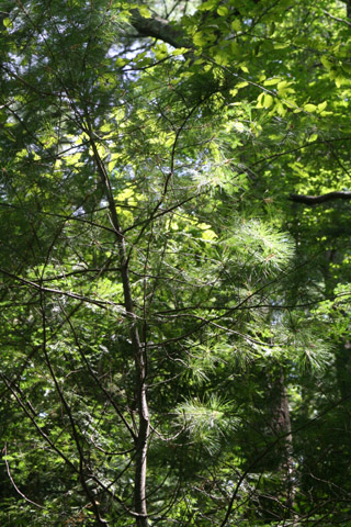
Pines on the hiltop along Breezy Hill Rd.
At this point I turned around to head back the way that I came. As I headed back, I was on the lookout for something that might have been the second country road shown on the map passing through the Edgecomb property. There is a small, unnamed lane that heads east just south of where the Ted Wright trail (and the abandoned road north) take off from Breezy Hill Rd. It wasn't passible by car, so I walked a short distance before turning around.
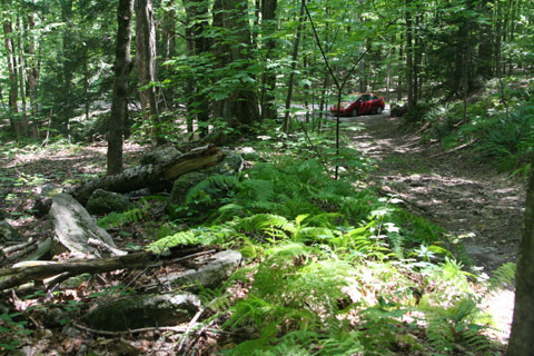
Unnamed lane east of Breezy Hill Rd. Could it be the second "country rode"?
Interestingly, there was actually a heap of stones at a location that I could have imagined to be the same as what was in the property description. It was probably a coincidence, given that there are probably hundreds of such piles in the area, placed there by farmers of the past who struggled to uncover enough dirt in which to plant crops. It surprises me little that those farmers would have chosen to leave this difficult land for the fertile soil of Ohio.
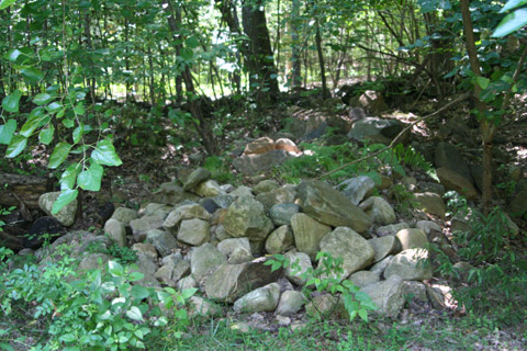
Heap of stones.
After this adventure, I spent some time looking at several cemeteries in a vain attempt to find the grave of either John or Uriah Edgecomb. There are many very old graves with completely illegible stones and other graves with no stones or stones that appear to have been destroyed. Unfortunately, I missed the grave of Ammi Humphreys, daughter of John Edgecomb, at the Dyer Cemetery in Canton. I will be sure to catch it if I'm ever in that part of Connecticut again.
Notes:
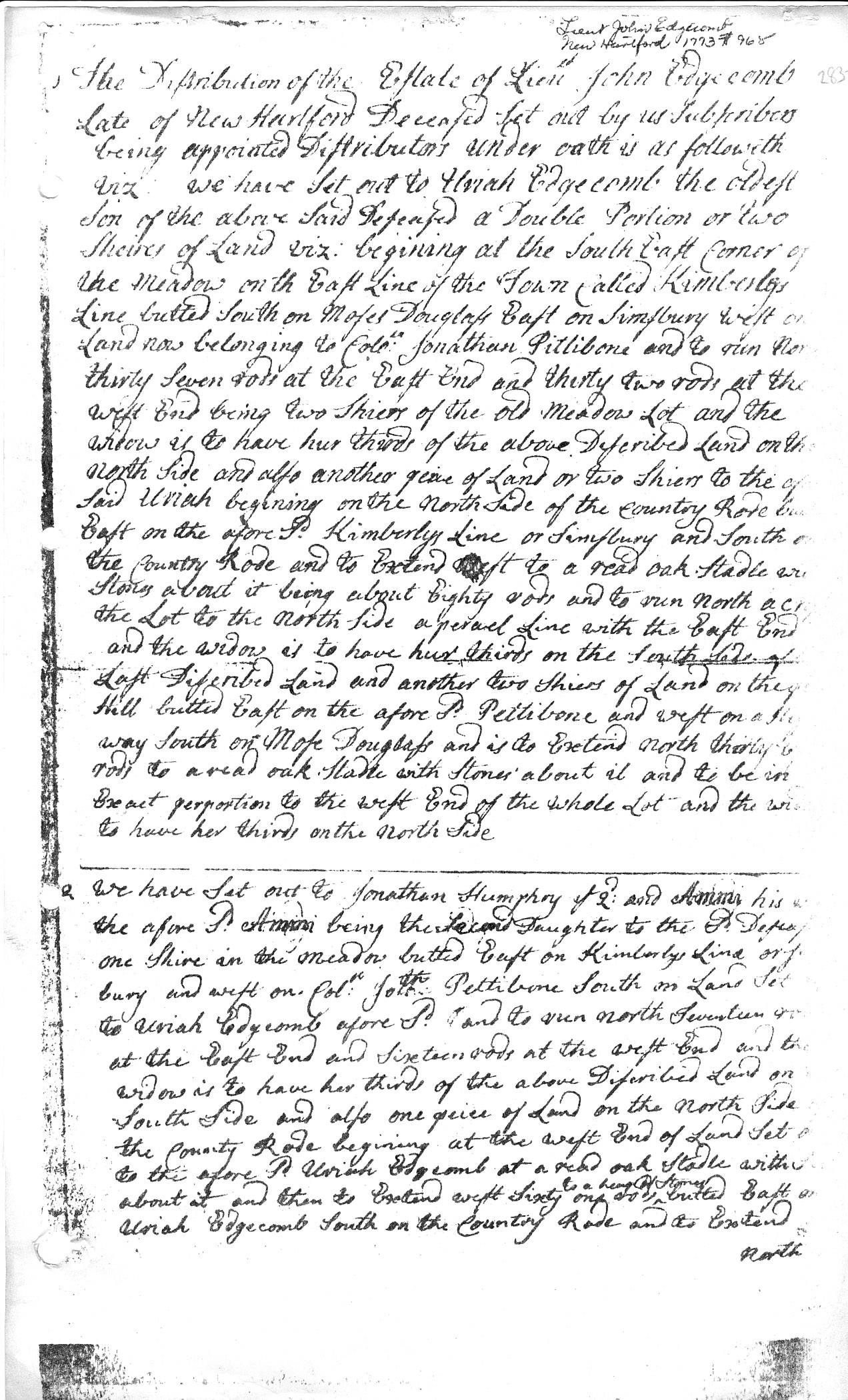
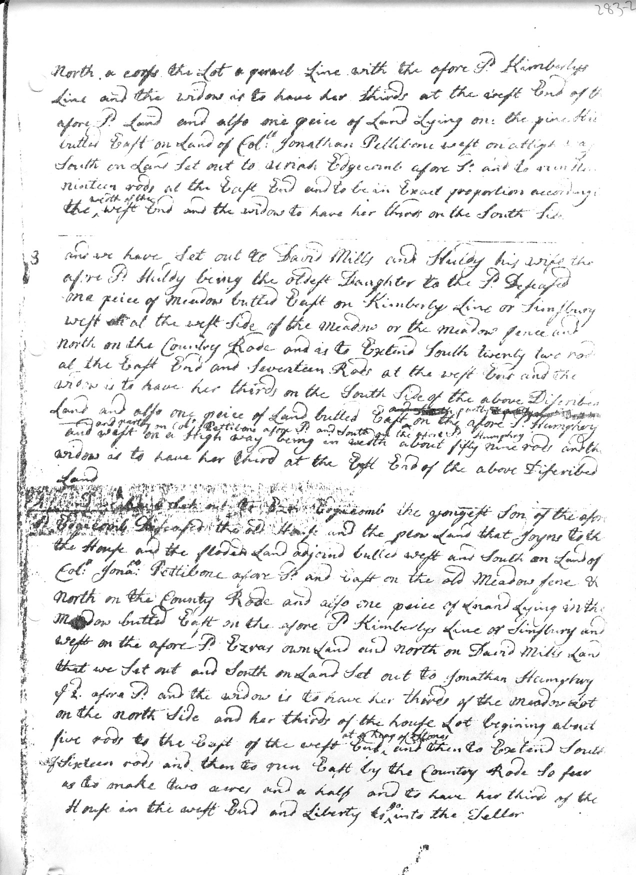
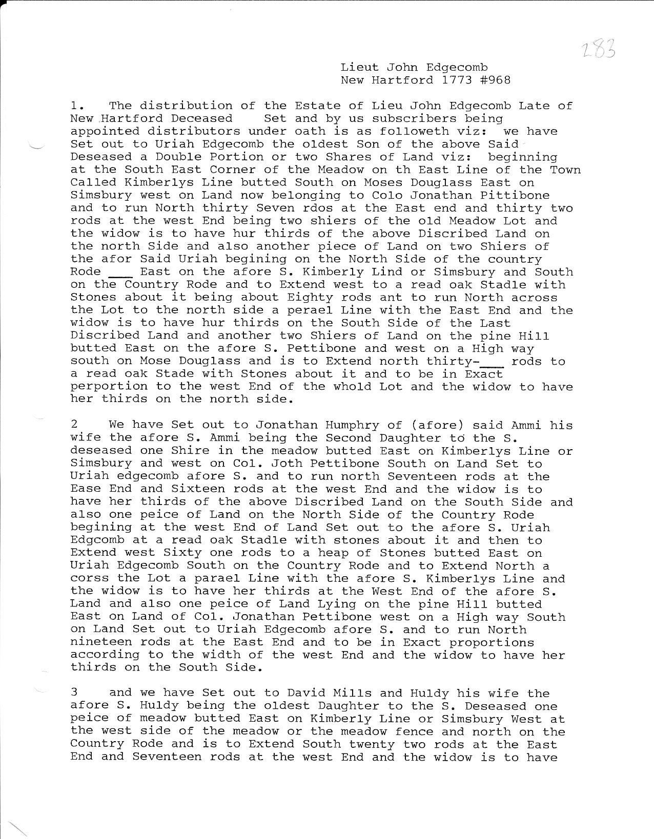
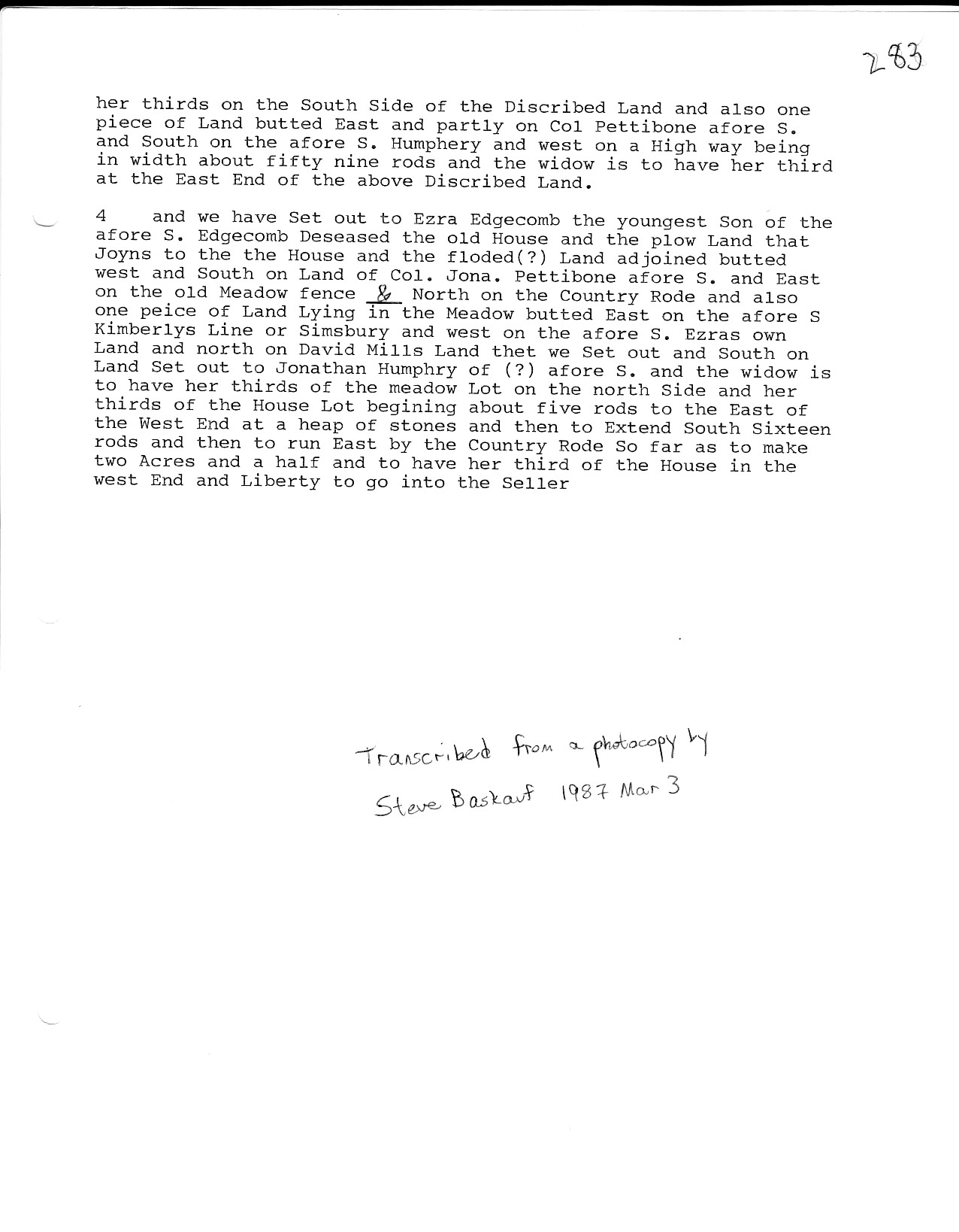
1. Connecticut Probate Records, Farmington District #968. First page scan Second page scan First page transcript Second page transcript
Written by Steve Baskauf - 8 February 2016.
.